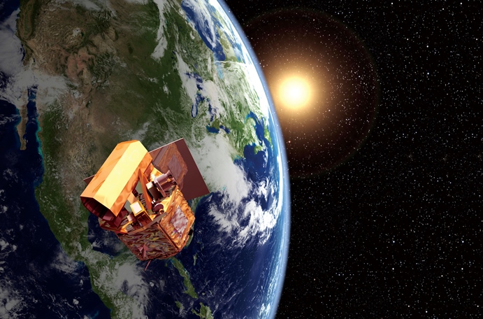
Launched in May 2004 and designed for a 5-year mission life, FORMOSAT-2 orbited the Earth and provided services for almost 2.5 times the length of its original mission life. FORMOSAT-2 encountered a malfunction caused by component aging and experienced critical failure in late June, 2016. After a thorough technical investigation and review, NSPO concluded that FORMOSAT-2 required decommissioning because of a fatal component failure.
Dr. Ching-Hua Lo, President of NARLabs, stated "FORMOSAT-2 produced an abundance of image and science data during its operations and is a great success for Taiwan's satellite program and a milestone for Taiwan's space program. I appreciate the domestic and global users, National Cheng Kung University's Imager of Sprites and Upper Atmospheric Lightnings science team, and NSPO's operations team for their support and hard efforts to prolong the life of the satallite."
Director Einer Bjørgo and his colleagues at United Nations Operational Satellite Applications Programme (UNOSAT) stated that “FORMOSTAT-2 was a great and reliable resource for United Nations disaster response work and that it played an important role in mapping impacts of disasters in Mozambique, the Philippines, Moldova, Uganda, Uruguay, Mauritania, Nepal, Tajikistan, Somalia, and many other locations. UNOSAT first used FORMOSTAT-2 imagery in 2006 and continued using it until 2015. This makes FORMOSTAT-2 one of our longest-running resources and its absence will be greatly missed. Thank you very much to NSPO and all the people who worked to deliver FORMOSTAT-2 data to us through the years. You are very much appreciated!" He further stated "Be it floods, storm, landslides, or earthquakes, FORMOSTAT-2 was able to deliver timely and useful imagery. We have benefitted from NSPO's imagery contributions both through the International Charter Space and Major Disasters, as well as bilaterally through in-kind data sharing, making disaster management more efficient and contributing to better coordination."
Director Ichiro Naito of the Satellite Applications & Operations Center of Japan Aerospace Exploration Agency (JAXA) also expressed his gratitude, "On behalf of JAXA, I would like to express our appreciation to FORMOSAT-2 and its operation team for their great support to Sentinel Asia with emergency observations, particularly with regard to the Great East Japan Earthquake in March 2011 and the Kumamoto Earthquake in April 2016. Your prompt support tremendously helped our disaster risk reduction (DRR) activities and I believe that it showed your satellites' capabilities in the DRR field. We will never forget your assistance."
After 12 years of operation and service, FORMOSAT-2 has accumulated over 2.5 million images provided to thousands of domestic and international users. With a unique daily revisit capability, FORMOSAT-2 provided quick access to images of disaster areas and continuous monitoring of information that was useful for rescue planning. Taiwan assisted in a total 343 events by providing FORMOSAT-2 images free of charge for humanitarian relief usage through international organizations including UNOSAT, Sentinel Asia, and the International Charter during its mission life.