According to the UN's 2016 statistics, more than half of the world's population lives in cities. Furthermore, cities with a high density of buildings are more significantly impacted by earthquakes, so improving disaster prevention and relief capabilities and building smart and resilient cities has become a priority issue for experts around the world.
The "5D Smart City Disaster Prevention & Relief Platform", created by NARLabs' National Center for Research on Earthquake Engineering (NCREE), is based on geographic information systems and integrates a variety of three-dimensional maps, including building information models, satellite images, aerial photography, and LiDAR point clouds. Most importantly, this platform's virtual city integrates NCREE's civil engineering expertise and algorithms, including a structural monitoring system, TELES (Taiwan Earthquake Loss Estimation System), and Twater, a specialized tool for earthquake risk assessment of water systems. These features enable the possible damage to urban buildings, bridges, and underground water pipes caused by earthquakes to be calculated.
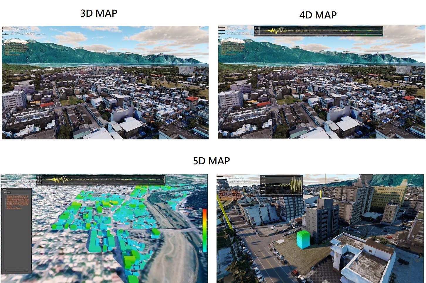 The above 3D map is an ordinary three-dimensional map of the city, while the 4D map shows the changes of seismic waves over time. NCREE's
 Pre-Earthquake Disaster Prevention and Mitigation, Post-Earthquake Emergency Response
The main applications of the "5D Smart City Disaster Prevention & Relief Platform" are pre-earthquake disaster prevention and mitigation and post-earthquake emergency response:
For pre-earthquake disaster prevention and mitigation, the platform uses simulation analysis to estimate disaster potential in each region. Through direct observation of earthquake damage on the platform, vulnerable areas can be more accurately pinpointed for advance mitigation efforts. The platform can also allow relevant authorities to keep track of the safety status of urban infrastructure so that regular maintenance and replacement can be conducted. As for post-earthquake emergency response, the platform can display the possible damage caused by an earthquake by simply inputting relevant parameters into the system, allowing disaster relief officers to view onscreen the distribution of buildings that may have suffered damage or collapsed.