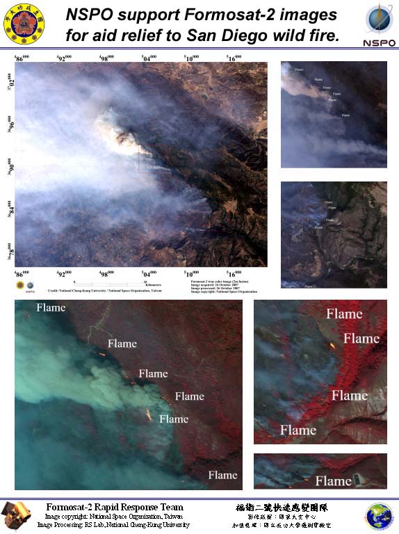
Taiwan remote sensing satellite, Formosat-2, aid rescue of wild fire of South Califoia: As soon as acknowledging the urgency of the wild fire of San Diego, NSPO voluntarily and immediately started to program Formosat-2 satellite to acquire images over the disaster area of South Califoia. Since 23 October 2007, NSPO has successfully acquired daily series of high-resolution images. The 1st set of images clearly revealed the areas under the raging of the fire and also the aftermath. These images have been analyzed by local research agencies and then distributed to the corresponding agencies, NCKU, provided the analysis result to the NASA earth observatory website. The wild fire has now forced over 880,000 people retreated from their home, and the estimated umber of the loss of the property is getting close to 1 billion USD. SDSU has shown their sincere gratitude to NSPO for the support of the Formosat-2 images. Formosat-2 was the 1st high resolution commercial remote sensing satellite used to support this emergency.San Diego State University: http://map.sdsu.edu/NASA:http://earthobservatory.nasa.gov/NaturalHazards/natural_hazards_v2.php3?img_id=14603&src=map