During the US-led Spire Weather – A Global Constellation Solution conference held between August 12th - 13th, renowned scientist, Sean Healy, of the European Centre for Medium-Range Weather Forecasts (ECMWF) announced that among all the observational data (including traditional methods, meteorological satellites, radio occultation data*, etc.) at the start of the year, which had contributed to 24-hour forecast errors in ECMWF’s numerical models, radio occultation data merely accounted for 4%. However, after observational data from FORMOSAT-7 satellites were officially added since March of this year, the research has shown a significant impROVement in errors from numerical weather prediction models. With the contribution of radio occultation data, 24-hour forecast errors have been raised from 4% to 10-11%.
Sean Healy also pointed out that climatologists would install large-scale climate sensors on commercial airplanes to collect climate data. The ongoing COVID-19 pandemic, however, has meant less global commercial travel and, therefore, data collected by such sensors have been greatly reduced. Fortunately, FORMOSAT-7, launched in 2019, has been able to fill this data gap.
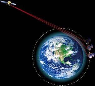
FORMOSAT-7 can receive radio wave signals emitted by GPS satellites. These signals pass through atmospheric layers of varying temperature, pressure, and humidity, which cause deviations in direction, speed reduction, and weakening. The signal’s characteristics need only be analyzed in order to determine the temperature, air pressure, humidity, and other data above the earth’s surface.
According to Dr. Chun-Liang Lin, Director General of National Space Organization (NSPO), NARLabs, after FORMOSAT-7 satellites passed the trial period, they have been officially pROViding data to international weather operation centers and research institutes, currently producing at least 4,000 radio occultation data per day. Through the tireless efforts of FORMOSAT-7’s teams in program engineering and satellite operations, any anomalies which may arise are quickly resolved to ensure the satellite is once again functioning properly, thereby securing the quality and quantity of its occultation data and achieving its mission.
The six satellites, which make up FORMOSAT-7 constellation, were launched in June 2019, to a temporary orbit of 720 km above Earth’s surface. Then they were successively deployed to six uniform orbital planes. Over a year has passed, and NSPO of NARLabs has successfully deployed four satellites to their mission orbit at an altitude of 550 km, and deployment of the fifth satellite will begin in late September of this year. The orbital deployment of all satellites is expected to be completed by February 2021**. By then, observation data will be evenly distributed between the north and south latitudes of 50 degrees, allowing the satellite constellation to pROVide greater assistance to weather forecast operations.
Map showing data pROVided by one of the FORMOSAT-7 satellites every 100-minute period.
Map showing data pROVided by six FORMOSAT-7 satellites during every 100-minute period.
Occultation technology illustration figure
* What are radio occultation data?
As electromagnetic wave signals emitted by GPS satellites pass through the atmosphere, they might deviate, slow down, and weaken as they travel across different layers of temperature, pressure or humidity. The signal’s characteristics need only be analyzed by FORMOSAT-7 in order to obtain data regarding the temperature, air pressure, humidity, and others above the earth’s surface.
** Why does the deployment of FORMOSAT-7’s six satellites need to wait until February 2021 to be completed?
The speed of the satellite will affect the orbit altitude. Satellites at 720 km orbit are jetted in the opposite direction of flight, causing the satellite to reduce speed and drop in orbit altitude.
After the first FORMOSAT-7 satellite was lowered to a mission orbit altitude of 550km, its orbital surface is affected by the earth’s oblate gravity field, generating about 0.55 degrees of orbital drift every day with the satellite staying at the 720 km orbit. After 108 days, the orbital plane of the first satellite orbiting 550 km high and the 720 km high satellite will both be separated by about 60 degrees. Afterwards, the second satellite began to descend from an altitude of 720 km to 550 km. After 108 days, the orbital planes of the second 550 km-high satellite and the 720 km-high satellite were also separated by about 60 degrees, while the orbital surface of the first 550 km-high satellite and that of the 720 km-high satellite have now been separated by about 120 degrees. In this way, the third, fourth, fifth, and sixth satellites are all subsequently lowered from an orbital altitude of 720 km to 550 km. This process will take a total of 540 days (108 x 5), starting from the first satellite lowering its orbital height and ending with the sixth satellite descending in orbit. Actually, it takes about 19 months in total if the satellite’s state of health (SOH) check during the first four weeks is included after satellites were launched. At this time, the orbital plane of the first 550km-high satellite and that of the second, third, fourth, fifth and sixth 550km-high satellites will have each been separated by 60, 120, 180, 240, and 300 degrees, and the deployment of the six-satellite constellation will be completed.